

Measuring
The Live screen
Section titled “The Live screen”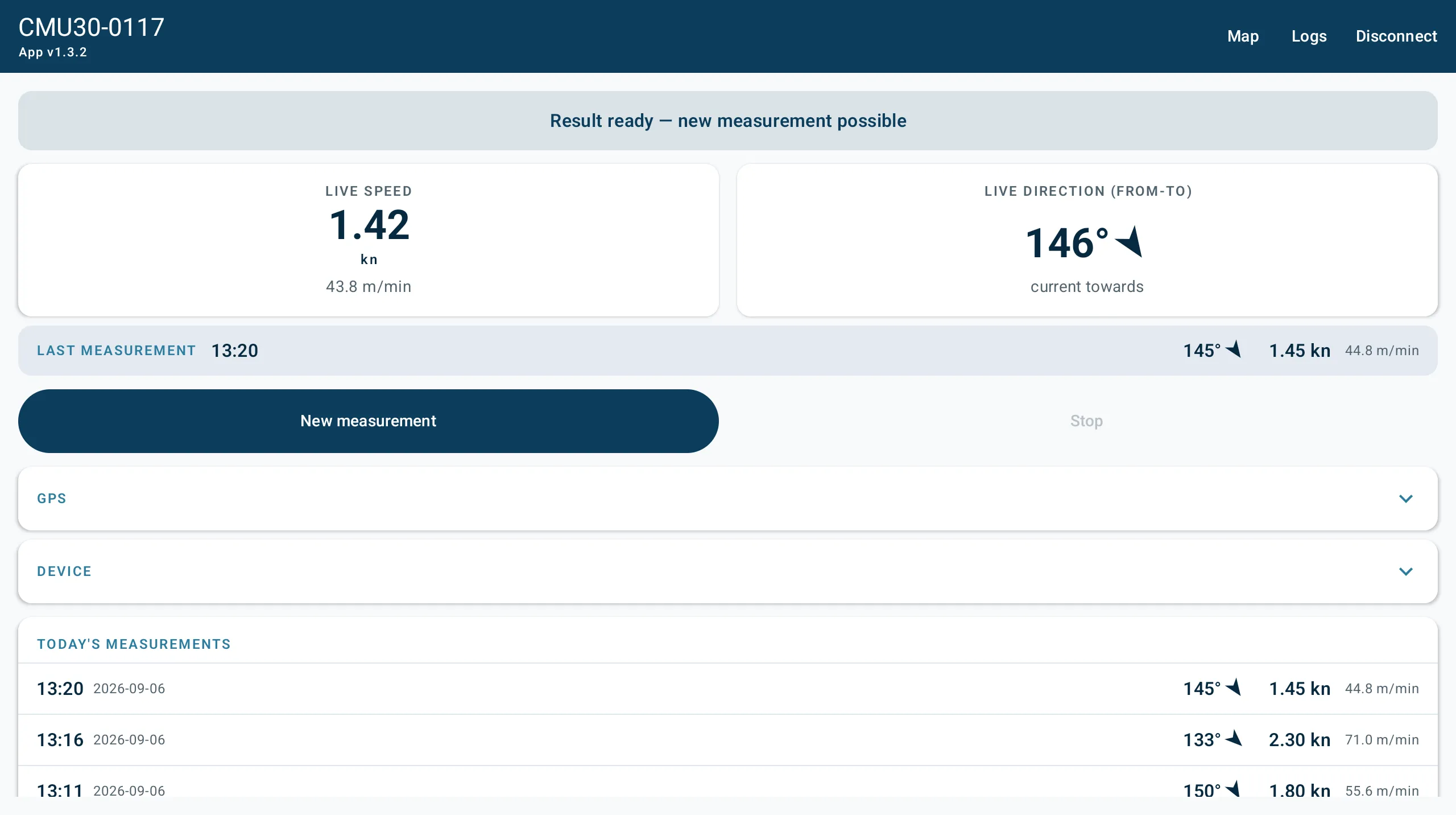
This is the main screen while connected. The top bar carries the buoy’s device ID on the left with the app version underneath, and Map, Logs and Disconnect on the right.
The state banner
Section titled “The state banner”One line, directly under the top bar, saying what the buoy is doing right now. It is colour-coded: amber while counting down, green while measuring, red for an invalid result.
| Banner | What it means |
|---|---|
| Waiting for GPS fix | No usable fix yet, so a measurement cannot start |
| Ready — press Start to deploy | Waiting for you |
| Deploy countdown — N s | Grace period before logging begins |
| Measuring — N s left | Logging the drift |
| Measurement done | Finished |
| Done — not enough valid samples | Finished, but rejected on quality |
| Result ready — new measurement possible | Result stored, ready to go again |
| Waiting for live data… | Connected, but no packet has arrived yet |
Live speed and live direction
Section titled “Live speed and live direction”The two large tiles show live speed in knots, with m/min underneath, and live direction in degrees with a small arrow.
The direction tile’s header states the convention in use, either LIVE DIRECTION (FROM-TO) or LIVE DIRECTION (FROM). See how the app words directions below.
Starting and stopping
Section titled “Starting and stopping”The left button reads Start, or New measurement when a result is already stored. The right button reads Stop, or Cancel deploy during the countdown.
Each button is enabled only in the states where the buoy will accept it — Start in Ready and Result ready, Stop during the countdown and while measuring. If a button looks greyed out, the banner above explains why.
If a command does not reach the buoy the app says Command failed — connection problem?. Check the connection and try again.
GPS and DEVICE
Section titled “GPS and DEVICE”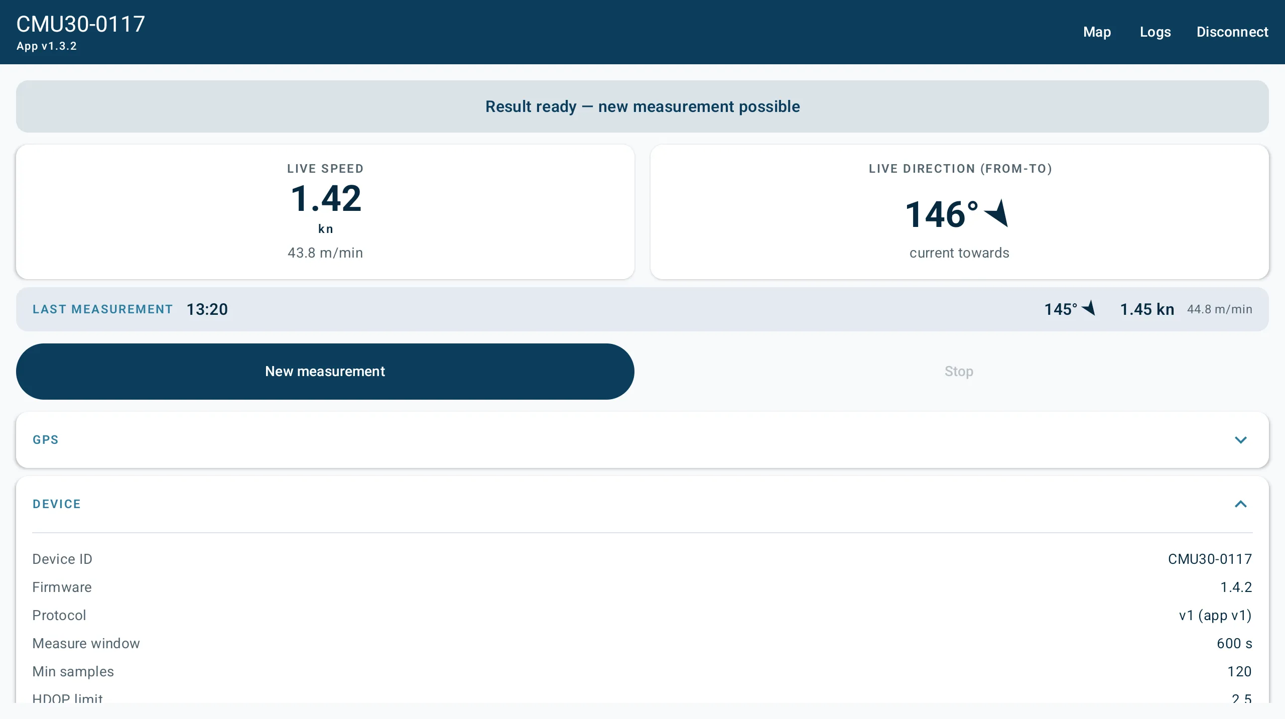
Two blocks, collapsed by default. Tap the header row to expand.
| Block | Shows |
|---|---|
| GPS | Position, fix quality, satellites, HDOP, GPS time in local time |
| DEVICE | Device ID, firmware, protocol, measure window, minimum samples, HDOP limit, direction mode, start mode, device timezone |
Both are read-only. They are the buoy’s own configuration, shown so you can check it without leaving the boat. To change any of it, use the buoy’s screen or its web interface.
Today’s measurements
Section titled “Today’s measurements”The bottom of the screen lists the day’s valid measurements, newest first, up to ten. Each row gives the time, date, direction and speed in both knots and m/min.
The app fetches recent results from the buoy in the background, so this section fills in shortly after you connect rather than immediately.
Saved measurements
Section titled “Saved measurements”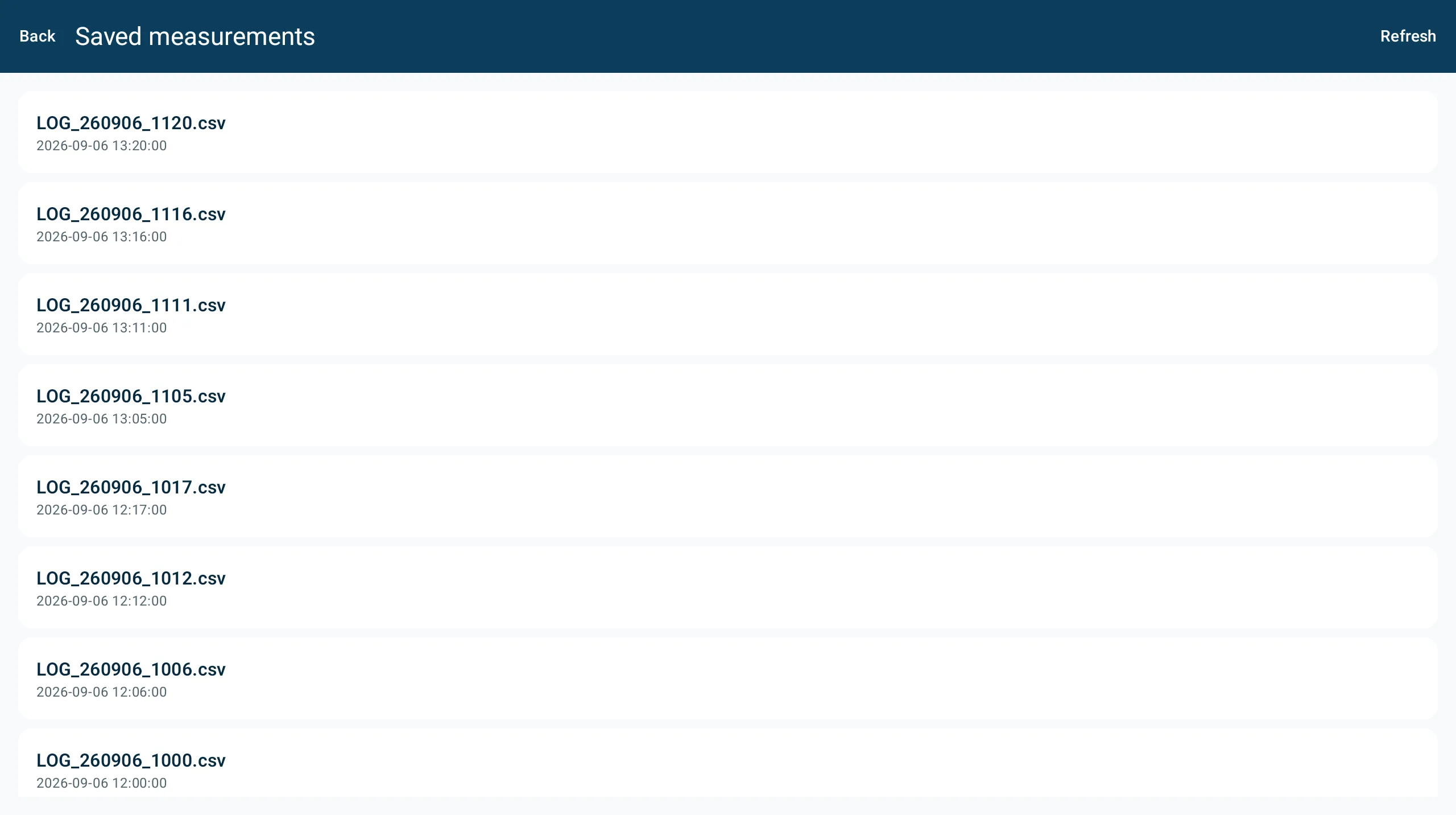
Open Logs from the Live top bar to see the measurement files on the buoy’s SD card, newest first, each with its file name and timestamp.
| Control | What it does |
|---|---|
| Refresh | Re-read the list from the buoy |
| Share | Download the file, then hand it to any app — mail, Drive, chat |
| Save | Download the file and write it to Downloads/DrifterBuoy |
Save needs Android 10 or newer. On older versions, use Share.
Downloads are checked with a CRC32 checksum, so a transfer that arrives damaged is reported rather than silently saved.
Files are CSV, one row per GPS sample, with a summary block at the end holding the averages. That footer is what the app reads to draw the map.
Times are always your phone’s times
Section titled “Times are always your phone’s times”Every timestamp the buoy produces is UTC, from GPS. Everywhere in the app, times are converted to your phone’s own timezone — the Live screen, today’s measurements, the file list, the map cards and the time-window ranges alike.
How the app words directions
Section titled “How the app words directions”The buoy can word a direction two ways, set by direction mode on the device:
| Mode | Means | Example |
|---|---|---|
| from-to | The direction the current flows towards | 146° = flowing towards the south-east |
| from | The direction the current comes from | The reciprocal, worded like wind |
This is a choice about wording numbers, nothing more. The measurement itself is always stored as the raw GPS course — the direction the water actually moved — so the setting cannot corrupt your data.
What this means in practice:
- Numbers follow the device’s setting, and the label beside them always says which convention is in force: LIVE DIRECTION (FROM-TO), current towards, (from 326°).
- Arrows on the map always point the way the current flows, whatever the setting is. An arrow is a vector, not a label. This holds for measured arrows and for the estimated field alike.
- Changing the setting on the buoy while the app is open is picked up within a second. The numbers change their wording; the arrows do not turn around.
- Opening an older measurement uses the current wording for its numbers. The convention is a display preference rather than a property of the measurement, and the buoy does not store one per file.
Next steps
Section titled “Next steps”- Map — plotting the day’s measurements
- Troubleshooting
- User Guide — what the measurements mean and how the buoy records them
v1.3.0 · 2026-09-29 · 8e84846